Hike date: June 29, 2017
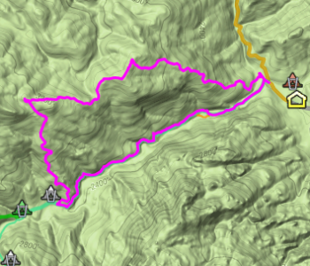
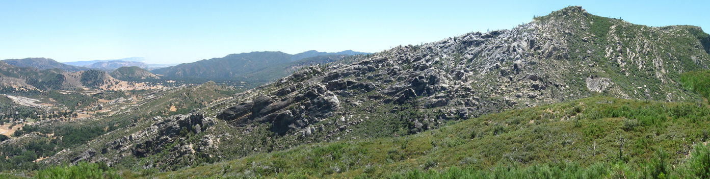
The Soberanes fire has greatly disrupted hiking activity in the Ventana Wilderness and caused extensive trail damage from downed trees, slides, etc. To make something positive out of the circumstances, I decided to use a firebreak opened up by the dozers to ascend the ridge north of the scenic “The Rocks” area near the Indians Guard Station, above the Arroyo Seco Trail, for some normally-difficult-to-get views.
Although the firebreak is evident on Google Earth, its eastern staring point is not – so finding it took a bit of on-the-ground searching.
But once found, it is apparent.
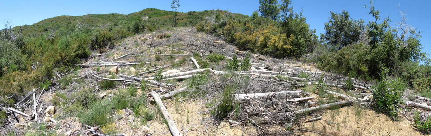
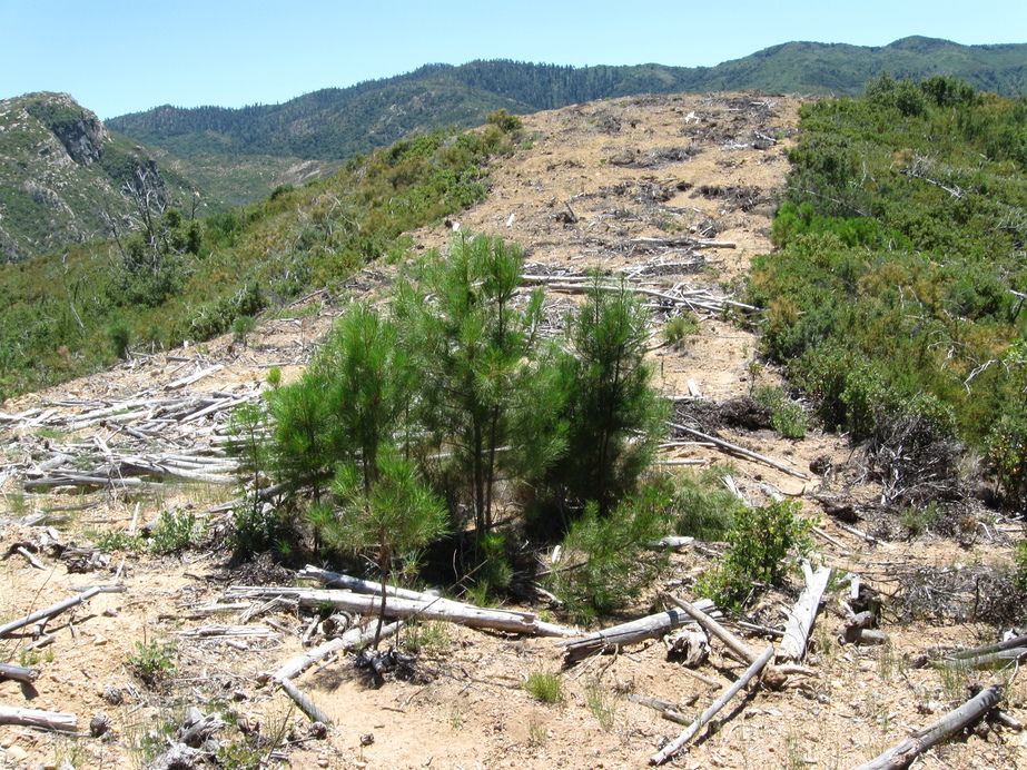
The firebreak is certainly not a hiking trail. The initial ascent was particularly steep, reminding me of the slant board I use to keep my Achilles tendon loose (to avoid bone spur problems, at 72 one of the foot problems I’ve developed). I had to weave through undulations created by dozers and dried brush strewn for erosion control.
Having balance issues (bad ear), I had to go slowly on the rough terrain. While I don’t usually hike with 2 poles, on this hike I did and was mightily glad.
As along the nearby Rodeo Flat Trail, there are many Coulter Pines. Those along the firebreak had been cleared and strewn along it, but I found one spared patch.
Unfortunately there is also much chaparral pea, my second-most hated plant. Small growths still – I got pleasure out of stomping on some as I went.
On the climb I often stopped to turn around and enjoy the view (that’s my excuse, and I’m sticking to it). At the top of the ridge I enjoyed the views while eating lunch.

Particularly interesting was the north view, where I could identify Black Cone, White Cone, Black Butte, and the Pine Ridge Trail ascending out of Church Creek divide (South Ventana Cone was hidden by White Cone).
After climbing another 0.8 miles along the ridgeline to the firebreak high point, the descent began. It was difficult, with poor footing and ground sliding away and the 2 poles were especially appreciated. Reminded me of descending the nearby Rodeo Flat trail – those who have done so can identify. Still, even though the slope was steeper this was easier, because the rough nature of the trail gave niches to place one’s feet and stop the descent. A surprise was finding usable water at 3050 ft – with swarming yellow jackets and stickleback plants just downslope.

There’s little shade on the firebreak – my day was a hot one, though thankfully with some wind. Flies were out but I had on gloves and a headnet – they landed on it, attracted to my face yet unable to get to me. But when I needed to remove the gloves, bites were frequent. And one deerfly did spook me – he flew straight into the optical viewfinder of my camera while taking a photo, so seeing something gigantic heading for my eyeball I involuntarily ducked.
Overall a very enjoyable day, getting views I could not along the Arroyo Seco Trail and well worth the effort. For anyone wanting to do the same, note that the eastern end is considerably steeper than the western end (averages: 24% vs 18%) and so better to start there – footing problems on descent would be much worse in the reverse direction.

Jack:
Thanks for this post. I love that hike! I am particularly intirgued by the little valley to the north that paralels the ridge on the top and would love to get down in there oone of threse days.
Jon
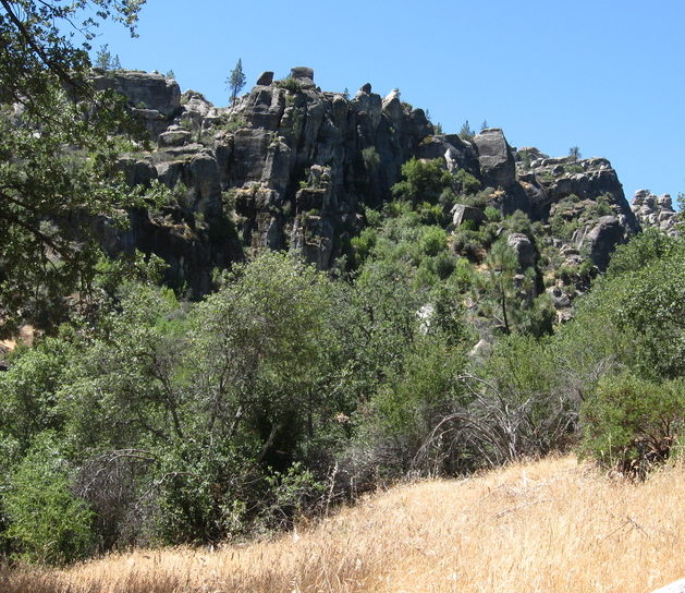
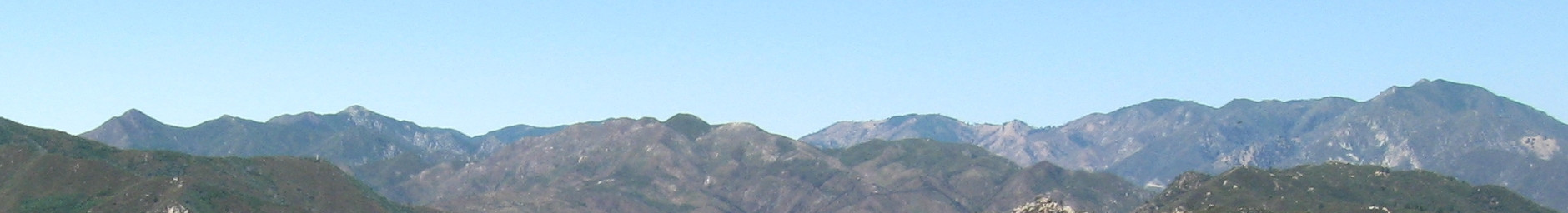
The view of “The Rocks” and Indians areas and Junipero Serra is certainly magnificent!
The firebreak may follow what was once an old road. If so, I don’t know why that road existed.