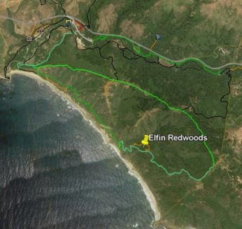
Elfin Redwoods – Andrew Molera SP (Click for interactive map)
I was ignorant – I called them Cypress trees. Actually, I knew they didn’t quite look like Cypress – but their wind-blown shaping was akin to what I’ve seen in Cypress and I didn’t know what else they might be. Surely not Redwoods, those magnificently tall trees we here on the Central Coast know so well – these trees were only 15-20 ft high.
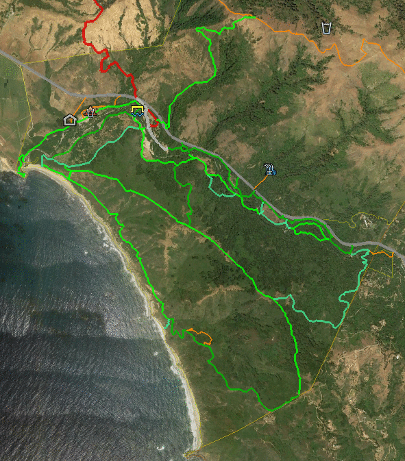
2016 & 2017 Molera SP Trailmaps (click for larger image)
I went out to see what the current Molera State Park looks like. Only the Post Summit ridgeline was burnt by the 2016 Soberanes fire – but the following winter’s heavy rainfall events caused the Big Sur River to overflow and flood lower sections of the park, notably its parking lot and campground. The park was closed for a long time, then re-opened this summer but with many trails closed. Currently only the Bluffs, Bobcat, Creamery Meadows, Panorama, Ridge, and Spring Trails are open.
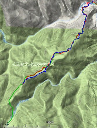
Round trip: 12 miles & 4000 ft gain & 12 hours Hike date: November 25, 2017
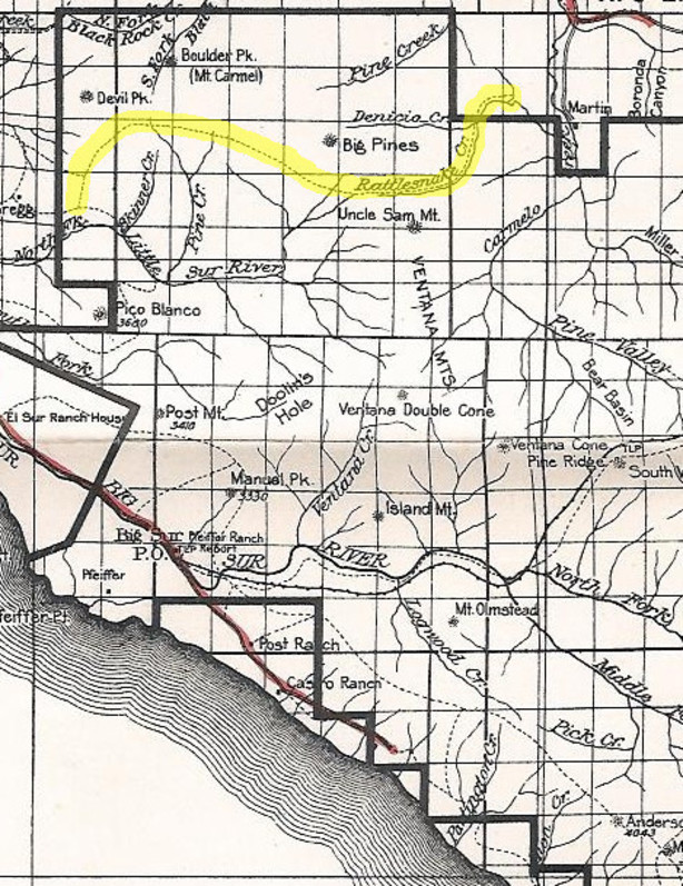
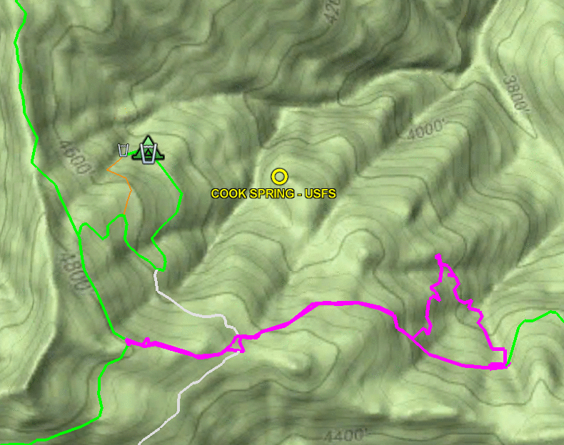
Route: Out (red) Return (yellow) Trail (green) (ignore “Rattlesnake Campground” label on map) (click for larger, interactive map) (kmz file)
Waking at 3:15AM is not my ideal way of starting a day – but today lack of daylight was not going to keep me from reaching Rattlesnake Camp. Last time I’d had to abort my attempt due to running out of daylight and energy. This time I would start earlier and would avoid the difficulty of trying to follow Rattlesnake Creek Trail – instead, it would be a bushwhack.
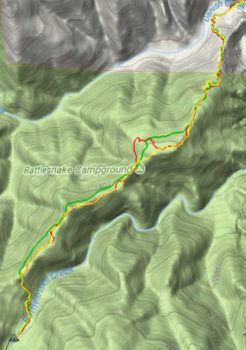
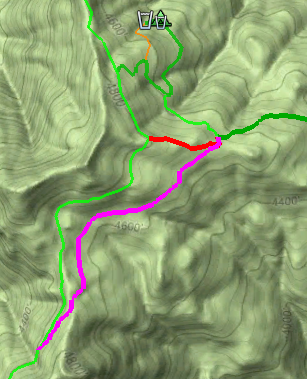
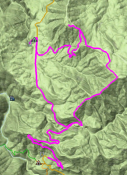
Round trip: 11.2 miles & 3760 ft gain & 11 hours Hike date: November 12, 2017
Route: Outbound (red) Return (blue) Trail (green) Note: Rattlesnake Camp NOT where map depicts (click for larger, interactive map)
Sadly, the lower half of Rattlesnake Creek Trail, below Rattlesnake Camp, is now impassable. This venerable trail was one of the oldest in the Ventana wilderness, having appeared on a 1921 quadrangle when few Ventana trails existed.
[Sorry folks, long post and not many photos – was spending all my time deciding where to go.]
1924 National Forest map (click for full-size image)
My “Finding the Carrizo Trail” post glossed over the fact that the western end of the Carrizo Trail of that time (2009) differed significantly from the current (2017) route. In my “Maps can lie” post, describing my mapping of that end, I had followed the route described in VWA Trail Reports: leave the North Coast Ridge Trail at a flag marking a ridge. At the time I’d noted the initial section was rough and sketchy, tread only becoming evident after leaving the ridge. I was later enlightened by Paul Danielson as we were hiking along the North Coast Ridge Trail – shortly after the Gamboa Trail junction, 0.6 miles before the ridge, he pointed out a spot where the “historic” Carrizo Trail junction had been. That route had become overgrown and abandoned, so hikers were instead taking a shortcut along an old dozer cut along the ridge.
In July of 2010, trailworker par excellence Robert Parks took it upon himself to restore that overgrown “historic” section. Over six worktrips, he and some helpers (including Paul Danielson) hacked and sawed their way through that brush. Much of the tread was still intact, so following the route itself was not too difficult. In October the final section was completed and a celebration held.
The Carrizo Trail is a historic route, used in the 1800’s by homesteaders driving their cattle and hogs to market in Jolon. After the construction of coastal highway it fell out of use but was later re-created by Steve Chambers and other VWA trailworkers, to connect the coastal ridge to the San Antonio River. But where exactly does it go? And where is the USFS “Carrizo Spring Camp” which lies along it?
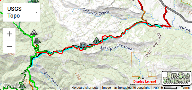
Round trip: 11 miles & 3500 ft elevation gain Hike date: October 6, 2017
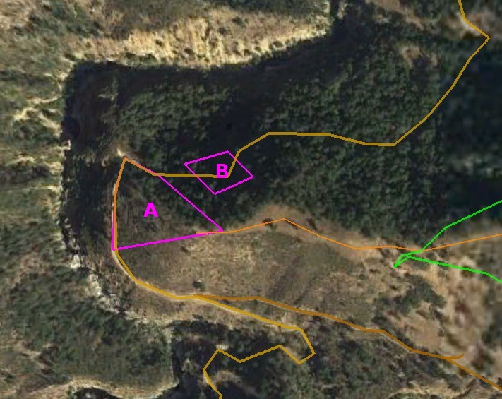
Carrizo Trail: 2009=red 2017=green (click to view interactive map)
Hearing that a section of the Carrizo Trail below Carrizo Spring Camp has recently been re-routed (see map), I went out to see what the new section looks like and GPS the new route. I found the trail has been moved out of the paralleling gully, into a drier environment. It should be subject to less overgrowth and easier to maintain – a definite improvement.
While I was out there, I decided to reprise my first Carrizo Trail mapping hike. That 2009 hike was motivated by wanting to find exactly where the trail went, since I’d found different routings on different maps. This hike would be more leisurely, for there has been significant trailwork along the entire trail since them. Back then there was much crawling in brush tunnels and much searching to find the trail – this time I only had to search once and never had to crawl! So I had more opportunity to look around and appreciate the trail and this hike and it was much more enjoyable.
Round trip: 12 miles & 2700 ft elevation gain
Hike date: July 2, 2017
(click for larger, interactive map)
Back in 2010 Paul Danielson and I GPS’d the Santa Lucia Trail from Eagle Creek north to Last Chance Camp, a 19-mile/14-hour marathon highlighted by crawling with a saw under an interlocked ceanothus brush canopy – no actual “trail” but the brush only let us move where the tread had been, other directions being impassable. To get there we’d taken an overgrown firebreak up from Indians-ArroyoSeco Road, which in turn led to an overgrown road. At the time Paul spoke of the other old roads that had once been there, now overgrown, and wanted to return later to explore them. We never did that, but with the Soberanes fire re-opening of the road from Hanging Valley to the ridge above, and the firebreak created along the ridgeline itself, I decided to take the opportunity to see the views from high above Hanging Valley.
Last Wednesday a fire broke out at Arroyo Seco, near the junction of ArroyoSeco-Indians Road and the road to the adobe. It was reportedly brought under control relatively quickly through aircraft retardant drops and the local USFS fire crew. I went out to see the aftermath.