Hike date: November 12, 2017
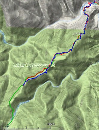
Note: Rattlesnake Camp NOT where map depicts
(click for larger, interactive map)
Sadly, the lower half of Rattlesnake Creek Trail, below Rattlesnake Camp, is now impassable. This venerable trail was one of the oldest in the Ventana wilderness, having appeared on a 1921 quadrangle when few Ventana trails existed.
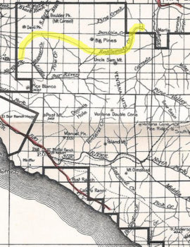
(click for full-size image)
The upper half of Rattlesnake Creek Trail has been “lost” since the 2008 Basin Complex fire – but the lower trail was still “passable”. I’ve done several lopping and sawing hikes to help keep it clear, the last exactly two years ago (Trail Report) . I’d heard that the lower trail was in bad condition after the 2016 Soberanes fire, having read a Trail Report from Bryce Winter who did a post-fire USFS survey hike – but hoped the conditions were not too much worse than those following the 2008 fire.
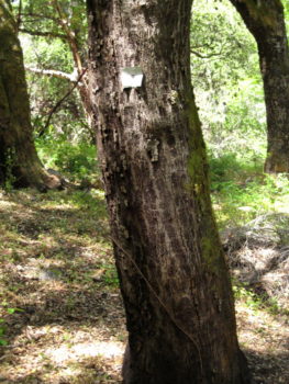
I’ve made 8 trips to Rattlesnake Camp (and some beyond it) since 2010 – so am very familiar with the trail. And I’d GPS’d it, so had that to help guide me. And this trail is unique in having metal markers spaced along it, allowing exact location of the the trail! All-in-all, I should be able to follow it despite brush and downfall, as I’d done in the past. What could go wrong?
(The metal markers were put up in the 1960’s by H.J. McCracken when he restored the trail – and they are responsible for keeping it from becoming “lost” in later years since they unambiguously locate the trail. The Sierra Club “Trail Guide to Los Padres National Forest” provides an intriguing vignette: “the grand old hiker who died in Anderson Canyon” – one wonders what is behind that story.)
Knowing I had to start early, sunset found Maria Ferdin and I at the Los Padres Dam parking lot. Entering via Danish Creek Camp, we crossed Danish Creek to start up the Rattlesnake Creek Trail at 9:15. It’s only 1.7 miles to the camp. Maria guessed we would be there at 11:30 – but my past experience made me skeptical.
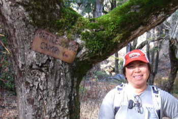
(click for full-size image)
The trail to Rattlesnake Camp first climbs the main ridge above Rattlesnake Creek ridge, then contours on or just below its ridgeline, and finally drops down to the creek and the camp. The initial ascent is through grass and below oaks. Numerous deer tracks head in every direction. It’s easy to get misled by those game trails, since they’re more prominent than any tread. Maria led, looking for trail indications – I followed, using the GPS to see when we got off-trail. There was little tread to follow so we were using the metal markers, which are relatively frequent along this section. Still, often none was visible and we tended to head for less brushy areas, the GPS then indicating were off-trail. So our path meandered around and about the trail. Without the GPS we would have had to spend considerable time trying to find the next marker, if trying to stay on the trail.
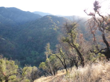
(click for full-size image)
At 10:55 we were near the top of the ridge – 2/3 of a mile done (at 0.4mph – geekiness alert: to allow valid comparisons, all speeds used are “towards camp”, i.e. do not include side-to-side wanderings – so actual foot speed was larger) and just 1 mile to go. Beyond there the metal markers become scarce and not very useful in locating the trail. We did find a few old flags (mostly mine, a few which were not). But no tread was visible, so we plowed ahead primarily relying upon the GPS. I remember once looking up to see a marker, without any indication of tread nearby. There was much brush and downfall, the most I’d ever seen along the trail, so our meanderings got larger. Lots of burnt shrub skeletons. Often pushing through the brush wasn’t possible, lopping or circumvention was required. We persevered and reached the ridgeline at 11:30 (0.4 mph), giving views down to Rattlesnake Creek watershed. Just 3/4 mile to go, we were half-way there.
(click for full-size image)
But then things got worse. After the 2008 fire a patch of ceanothus had sprouted along the next trail section, which lies below the ridgeline. I’d cut a path though it then, but it was narrow. Now the ceanothus was more extensive and had much downfall in it. Again without tread to follow, we had to rely upon the GPS. At one point I did find that narrow cleared path, but following it required crawling and it quickly became blocked. The GPS was leading us through nearly impassable sections of brush and downfall – we were hardly moving. So we headed downslope a bit, where the brush lessened and paralleled the trail. Still, the next 0.2 miles took us 45 minutes (less than 0.3 mph). And after continually having to fight obstacles, we were weary.
The ridgeline bends beyond that point, so to save time we cut the corner. The brush was less thick there and at 12:30 we ate lunch, with a view of the Danish Creek watershed.

(click for full-size image)
Now just under 1/2 mile to the camp – but only 4 hours to sunset. We had headlamps, but I wanted to get back to a followable path before dark. Past experience told me the section to come was likely more brushy than what we had come through. I could not see us being able to get to the camp and back to Danish Creek before dark – and we certainly would not be able to spend any time at the camp. So reluctantly we turned around.
In heading back we decided to follow a different strategy. Outbound we had roughly followed the old trail, thinking that could provide easier passage through the brush and also wanting to do some clearing and put up flags, as I’d done on previous visits. But there was too much brush to clear and we were not staying on the trail so had stopped putting up flags – nothing was being accomplished there. So to return we decided to just bushwhack back the best we could. We were atop the ridgeline and the non-trail side of the ridge was grassy, so that slope seemed the way to go. We used it for the next 1/4 mile til we got back to the ridgeline. Our speed was twice that over the same distance on the way out ! And required much less effort! After that the grass disappeared and we had to go back to the trail-side of the ridge. But we were now just looking for less-brushy spots, not worrying about where the trail lay.
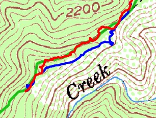
We got back to Danish Creek at 3:30. Opting to take the shortest way back, we climbed the old road leading to Big Pines Trail. While our tired bodies did not welcome the 700 ft ascent, it was VERY nice to have a tread under our feet – all-in-all, it was less strenuous than the bushwhacking had been.
From the Big Pines Trail we took the old road down to Los Padres Dam. For those who know that road, which pre-fire was in excellent condition having been cleared for some unknown reason, now the creek which had been alongside it has carved a new channel running down the road itself – and with the strong rains we’d had, that channel is deep. And surface rocks abound. Hiking it took some concentration, not the easy-going route that it had been before.
Dusk fell as we approached the dam, we were back at the car 45 minutes after sunset.
As in many bushwhacks, there was a loss – the brush says “gimme”, wanting to grab anything loose. I lost the tip of my spare pole, it not being secured tightly enough (but can replace it with one I had previously lost which was later found by Betsy MacGowan in the brushy section of the Marble Peak Trail – the brush taketh, but sometimes giveth back). Maria lost her camera – but knew roughly where, so on our return trip we carefully backtracked that section using the GPS and found it hanging by its strap from a branch.
So now what. Rattlesnake Creek Trail is currently “lost”. Although I’d previously hiked it when it was in poor shape, back then there were still sections of tread to follow – one just had to find connections between them. But now there is little tread to find. And brush or downfall blocks much of the trail anyway. Following the trail is just not possible, even when one knows where it lies. Even with a GPS. That is discouraging, but it is what it is.
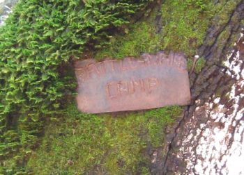
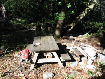
I still want to get to Rattlesnake Camp. I’ve always felt an attraction to it – a peaceful, nearly forgotten camp set beneath trees alongside a pleasant creek – with a usable picnic table as a bonus. It has escaped numerous fires in the past and I want to see what it is like now, having heard that it was also largely untouched by the Soberanes fire.
(click for full-size image)
(click for full-size image)
But how to get there? My plan for my next attempt is to just bushwhack, looking for the least-energy-expending route. I’ve used Google Earth to lay out what appears to be a “least brushy” route, which I’ll try to follow, to see what it looks like on the ground. Certainly following the grassy side of the ridge for that one section saved considerable time. Though daylight hours are decreasing, by starting before sunrise and returning well after dark I should be able to dayhike there. Well, time will tell.
I’ve GPS’d a number of “nearly lost” trails, such as the north end of the Lost Trail – but in those cases sections of tread could be found with some searching, even if buried beneath brush and downfall, and the dots between them connected. But here there is very little tread to be found – and those segments which do remain are short. And there is much brush and downfall to contend with. It’s worse than other “lost” trails I’ve encountered – thinking for instance of the Mt. Manual Trail between Launtz Creek and Vado Camps, for which tread is non-existent for long stretches yet is largely brush-free so passage is not that difficult. I must rate the Rattlesnake Creek Trail impassable. If you want to get to Rattlesnake Camp, I suggest you do so via bushwhack instead of trying to follow the “trail”.
Jack, thanks for the trail update. Was thinking of trying to hike the trail but your report is discouraging. If you want some company on a future attempt, let me know!
Paul
Good to hear from you. I’m very motivated to get out to Rattlesnake Camp so planning on making another attempt soon. I have your “privacy” email address so will send a detailed email to you.
Jack