(click for larger size)
I‘ve been asked how/why I began to GPS the Ventana/SilverPeak trails. I’ve told this story to some in brief – here is the whole story.
Though living on the Monterey Peninsula since 1985, most of my spare time had been spent in flying activities, both powered and unpowered. My hiking activity was sporadic and mostly close to home, though I had gone on Sierra Club hikes to Pine Valley and Vicente Flat. But on June 21, 2008 – yes, the day the first lightning-strike Basin Complex fire broke out – I had my own personal fire, in the engine bay of my self-launching sailplane while in-flight. [A long story, not germane here.] Such aircraft are not mass produced so servicing options are few. Mine was manufactured in Germany and the engine had to be sent back there for repair – and then parts became unavailable when the manufacturer went into bankruptcy. For a long time its future status was unknown [Another long story – eventually it took 2 years to get the engine back]. I then had a lot of spare time.

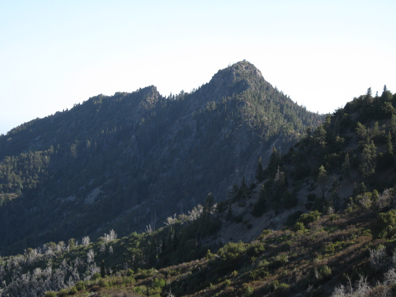
So I expanded my hiking activities, and after the post-fire re-openings started exploring Molera and Julia Pfieffer Burns State Parks and eventually the Ventana wilderness. In September 2009 I decided to see the Cone Peak environs for the first time, planning to summit and then explore out to Cook Spring. I could only get my low-slung BMW in to the top of the Vicente Flat Trail so from there went by foot for what would be a 15mile/10hour hike. My first-time views from the Cone Peak Trail down to the ocean and the summit panoramas were certainly impressive.
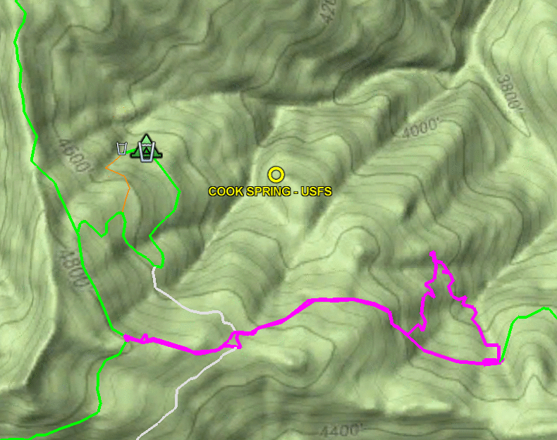
But the story here is my attempt to find Cook Spring Camp. According to the on-line USFS map I’d found (shown above), the camp lies at the end of a spur off the Carrizo Trail. I’d read the VWA forum Carrizo Trail “Trail Condition” reports and knew that trail’s upper end was not in good shape, so expected some difficulty and put the Cook Spring Camp lat/lon coordinates into my GPS “just in case”. Hiking out the North Coast Ridge Trail, I find two flags where I expected the Carrizo Trail to intersect, according to the map, so off I go.
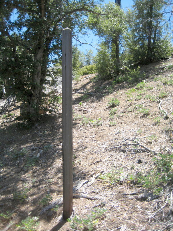
At the time I had little experience of how Ventana trail conditions can vary, but quickly realize that following this “trail” is going to be challenging. I don’t see any tread, just spaces between bushes – is this is really a trail ? (and indeed later learned it is actually an old dozer cut). Then I find a post which had once held a sign, which is reassuring, and the route becomes more obvious, with faint tread to follow. So I continue, keeping an eye out for that side trail. Yet nothing appears and I finally decide I am well beyond where it could have been.

But I’ve done my pre-hike planning and am prepared – I can lock my GPS in on the camp and go there directly. So off I go. But there are many abrupt, steep ups-and-downs through manzanita and ceanothus brush – not much fun. This Ventana novice discovers what Ventana bushwhacking can be like – how difficult the rugged terrain can be and how unyielding the brush. After 20 minutes I’ve moved 900 ft – getting to the camp this way would take at least another 30 minutes. And I’m tired and slowing down. It’s already been a long day, so I lick my wounds and start back (it took another 30 minutes just to get back to the tread).
Returning home, I explored the VWA forum in more depth and discovered that one was supposed to reach Cook Spring from a spur off the North Coast Ridge Trail! Who knew! Not this Ventana novice.
Years later later, I learned that the map I’d used was specially created by the USFS because the standard USGS quadrangles did not show many trails or camps in the Ventana wilderness – and those it did show were often incorrect. So around 1995 the USFS decided to to create their own versions with their trail and camp locations overlaid. A very laudable aim – however it turns out their own data is also often incorrect! In particular, I later learn that not only is their location of the spur trail leading to Cook Spring Camp incorrect, but their location for the camp itself is incorrect! It lies on a neighboring ridgelet, not the one indicated. So if I had followed my GPS all the way to that spot, I would have found – nothing !
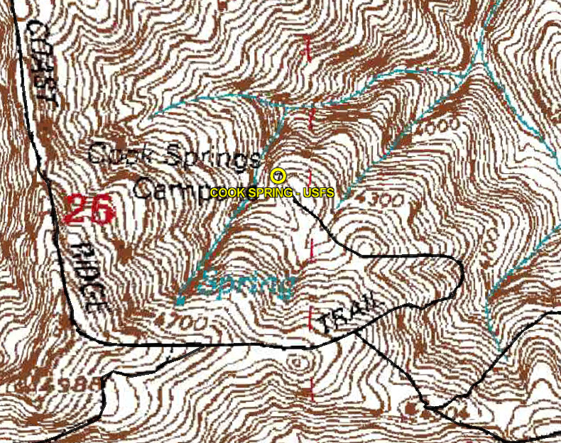

The top animated map, created from the static images above, illustrates this story. The brown contours are the USFS-provided map with their black-line trails, on which I’ve highlighted their location for Cook Spring. The green terrain map shows my route (magenta), and the actual locations of Cook Spring Camp and the then-existing trails in green. Years later, Robert Parks and others worked to re-open two trails which had been long overgrown and unused – the “historic” Carrizo Trail (which intersects the North Coast Ridge Trail at a different spot – Carrizo Trail hikers were instead taking the dozer shortcut) and a connector from my reassuring post to Cook Spring Camp – those are shown in gray.
This experience was an eye-opener for me. In my previous hiking experience, mostly in the Colorado Rockies and back east in the New Hampshire White Mountains, where trails are long established and well travelled, the maps could be relied upon. But not here. I saw a need – and having used GPS in my flying (at the time it was not yet in widespread popular use) I knew how the problem could be rectified. So I decided I needed to explore the Ventana further and find where its trails really went.
Postscript: In 2012 Mike Heard and I bushwhacked to the USFS “Cook Spring Camp” location just to see if there might in fact be something there. We found – nothing.